All the lisps and macros have been provided considering the needs of thousands of professionals in the Civil and Surveying Industry. This area was extensively researched and designed this product to directly target their needs and demands.
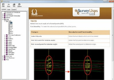
Under Text categories, you can rotate, change angle or align texts with respect to selected text or parallel to line. Also, you can change case and justification of text.
Under Lines, you can join points or blocks and find overlapping lines. Also, mark intersecting lines of different layers.
Under Polylines, you can convert connected lines to Polyline, reverse and measure each segment and cumulative distance of polyline, mark chainages and each node and measure clockwise / anticlockwise bearing. Also, find total length of selected line and put the gradient.
Under Blocks, you can insert block at the end point or at intersection or between selected points. Also, you can scale and change blocks in the drawing.
Under Layer, you can pick the text for layer name; move each text of specified layer individually. You can show layer by layer and use layer manager to accomplish other tasks.
Under Select, you can initiate jump to text of same layer and other text. Select entities within a polygon.
Under Mathematics and Statistics, you can find the minimum and maximum numeric value amongst the selected texts. View the basic statistics of the selected texts and also insert the summation for the selected texts.
Under Drawing Utilities, you can measure distance, draw grid, show entities of specified color. Also, snap text to nearest grid point and trim around selected text and repeat measure command.
Under Import and Export, you can extract text within polygon boundary and export selected objects to CSV file and import text from CSV file as AutoCAD points.
Under Import and Export, you can extract text within polygon boundary and export selected objects to CSV file and import text from CSV file as AutoCAD points.
Under 3D Polyline, you can create 3D line by selecting elevation texts in different combination. Also, you can remove z value of all the vertex of a polyline (Convert 3d polyline into 2D polyline).
Under Interpolate, you can interpolate at midpoint, at a given point and N values between given points and interpolate at given distance. Also interpolate randomly on basis of the selected texts under an interval
Comments